Geolocate

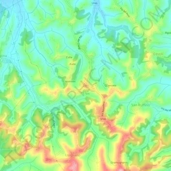
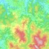
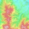
Lari topographic map

Click on the map to display elevation.

Lari

Lari is a walled mountaintop frazione, or hamlet, in the comune of Casciana Terme Lari, 60 kilometres (37 mi) southwest of Florence and 25 kilometres (16 mi) southeast of Pisa, in the Tuscany region of Italy. The municipal seat of its comune, Lari dates from at least the 9th century BC, a fact established by its traces of Etruscan architecture. It sits at a high elevation for Tuscany and centers around a castle, with distant views in all directions. Physician Eusebio Valli was born in the hamlet.

Wikipedia (CC-BY-SA 3.0)

About this map

Name: Lari topographic map, elevation, terrain.

Location: Lari, Casciana Terme Lari, Pisa, Tuscany, 56035, Italy (43.54602 10.57200 43.58602 10.61200)

Average elevation: 80 m

Minimum elevation: 31 m

Maximum elevation: 167 m

Other topographic maps

Click on a map to view its topography, its elevation and its terrain.
Volterra

Italy > Tuscany > Pisa

Average elevation: 228 m

Volterra

Italy > Tuscany > Pisa

Average elevation: 228 m

Terricciola

Italy > Tuscany > Pisa

Average elevation: 94 m

Guardistallo

Italy > Tuscany > Pisa

Average elevation: 108 m

Montescudaio

Italy > Tuscany > Pisa

Average elevation: 111 m

Pomarance

Italy > Tuscany > Pisa

Average elevation: 342 m

Castelnuovo di Val di Cecina

Italy > Tuscany > Pisa

Average elevation: 424 m

Pisa

Italy > Tuscany > Pisa

Average elevation: 11 m

Pisa

Italy > Tuscany > Pisa

Average elevation: 11 m

Santa Maria a Monte

Italy > Tuscany > Pisa

Average elevation: 33 m

Pomarance

Italy > Tuscany > Pisa

Average elevation: 342 m

Montescudaio

Italy > Tuscany > Pisa

Average elevation: 111 m

Chianni

Italy > Tuscany > Pisa

Average elevation: 300 m

Pisa

Italy > Tuscany > Pisa

Average elevation: 11 m

Pontedera

Italy > Tuscany > Pisa

Average elevation: 26 m

Castelnuovo di Val di Cecina

Italy > Tuscany > Pisa

Average elevation: 424 m

Pontedera

Italy > Tuscany > Pisa

Average elevation: 26 m

Monteverdi Marittimo

Italy > Tuscany > Pisa

Average elevation: 253 m

Gear up for your next adventure:

🧦Merino Wool Hiking Socks - Moisture-wicking socks to prevent blisters during long topographic surveys
🎨Portable Watercolor Kits - Paint the landscapes and topographic views you discover
🔌Fast Charging Adapters - Quickly top up all your gear before heading back into the field
👣Snake & Scrub Gaiters - Protection against spinifex, mud, and snakes while walking off-track
🏕️Camping Gear - Essential camping equipment

As an Amazon Associate, this site earns from qualifying purchases at no extra cost to you.