
蔡家庄 topographic map
Interactive map
Click on the map to display elevation.
About this map
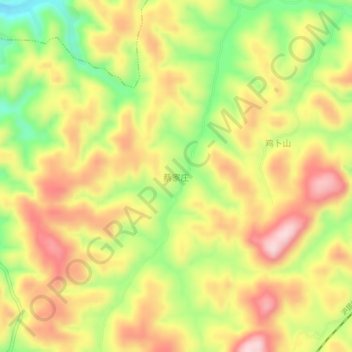
Name: 蔡家庄 topographic map, elevation, terrain.
Location: 蔡家庄, 杨柳塘, 施秉县, 黔东南苗族侗族自治州, 贵州省, 中国 (26.95070 108.14500 26.99070 108.18500)
Average elevation: 799 m
Minimum elevation: 651 m
Maximum elevation: 925 m