
Make a donation
Gear up for your next adventure:
As an Amazon Associate, this site earns from qualifying purchases at no extra cost to you.
Imola topographic map
Click on the map to display elevation.
Make a donation
Gear up for your next adventure:
As an Amazon Associate, this site earns from qualifying purchases at no extra cost to you.
About this map
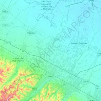
Name: Imola topographic map, elevation, terrain.
Average elevation: 49 m
Minimum elevation: 0 m
Maximum elevation: 459 m
Make a donation
Gear up for your next adventure:
As an Amazon Associate, this site earns from qualifying purchases at no extra cost to you.
Other topographic maps
Click on a map to view its topography, its elevation and its terrain.
La battaglia del Monte Castello
Italy > Emilia-Romagna > Bologna > Abetaia
Monte Castello is a hill located about 48 km (30 mi) north of Pistoia (Tuscany) and 60 km (37 mi) southwest of Bologna (Emilia-Romagna), via Località Abetaia (SP623), near Abetaia di Gaggio Montano, coordinates 44.221799, 10.954227, at 977 m (3,205 ft) altitude, in the Northern Apennines. on the border…
Average elevation: 845 m