
Thank you for supporting this site ❤️
Make a donation
Make a donation
Gear up for your next adventure:
As an Amazon Associate, this site earns from qualifying purchases at no extra cost to you.
Hemingford topographic map
Click on the map to display elevation.
Thank you for supporting this site ❤️
Make a donation
Make a donation
Gear up for your next adventure:
As an Amazon Associate, this site earns from qualifying purchases at no extra cost to you.
About this map
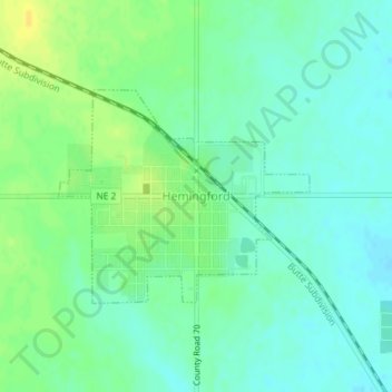
Name: Hemingford topographic map, elevation, terrain.
Location: Hemingford, Box Butte County, Nebraska, United States (42.31416 -103.08575 42.32889 -103.06229)
Average elevation: 1,298 m
Minimum elevation: 1,289 m
Maximum elevation: 1,311 m
Thank you for supporting this site ❤️
Make a donation
Make a donation
Gear up for your next adventure:
As an Amazon Associate, this site earns from qualifying purchases at no extra cost to you.