
A Airoa topographic map
Interactive map
Click on the map to display elevation.
About this map
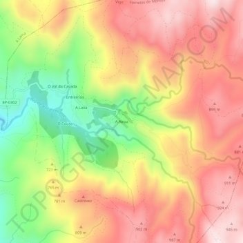
Name: A Airoa topographic map, elevation, terrain.
Average elevation: 740 m
Minimum elevation: 452 m
Maximum elevation: 959 m
Other topographic maps
Click on a map to view its topography, its elevation and its terrain.
Fornelos de Montes
España > Galicia > Vigo > Fornelos de Montes
Fornelos de Montes, Vigo, Pontevedra, Galicia, 36847, España
Average elevation: 485 m