
Manapur topographic map
Interactive map
Click on the map to display elevation.
About this map
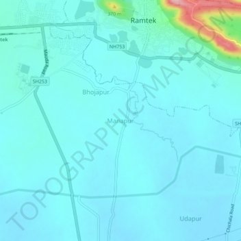
Name: Manapur topographic map, elevation, terrain.
Location: Manapur, Ramtek Taluka, Nagpur, Maharashtra, 441401, India (21.35911 79.30167 21.39911 79.34167)
Average elevation: 318 m
Minimum elevation: 299 m
Maximum elevation: 463 m
Other topographic maps
Click on a map to view its topography, its elevation and its terrain.
Mansar
India > Maharashtra > Ramtek Taluka
Mansar, Ramtek Taluka, Nagpur, Maharashtra, 441406, India
Average elevation: 331 m