Geolocate

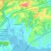
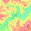
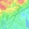
Dublin topographic map

Click on the map to display elevation.

About this map

Name: Dublin topographic map, elevation, terrain.

Location: Dublin, Harford County, Maryland, United States (39.63099 -76.28662 39.67099 -76.24662)

Average elevation: 117 m

Minimum elevation: 63 m

Maximum elevation: 149 m

Other topographic maps

Click on a map to view its topography, its elevation and its terrain.
Aberdeen

United States > Maryland > Harford County

Average elevation: 40 m

Abingdon

United States > Maryland > Harford County > Riverside

Average elevation: 22 m

Edgewood

United States > Maryland > Harford County > Edgewood

Average elevation: 12 m

Bel Air

United States > Maryland > Harford County

Average elevation: 103 m

Fallston

United States > Maryland > Harford County > Fallston

Average elevation: 132 m

Big Branch

United States > Maryland > Harford County > Eden Hills

Average elevation: 163 m

Bel Air

United States > Maryland > Harford County

Average elevation: 103 m

Bel Air

United States > Maryland > Harford County

Average elevation: 103 m

Gear up for your next adventure:

🕶️Polarized Sunglasses - UV protection sunglasses for outdoors
⌚Altimeter Watches - Watches with altitude tracking
🌬️Windbreaker Jackets - Wind protection jackets
🖼️Scratch-off Australia Map - Track the regions and peaks you have explored geographically
🌿Flora and Fauna Field Guides - Identify the plants and animals you encounter on your route

As an Amazon Associate, this site earns from qualifying purchases at no extra cost to you.