
Thank you for supporting this site ❤️
Make a donation
Make a donation
Gear up for your next adventure:
As an Amazon Associate, this site earns from qualifying purchases at no extra cost to you.
Kavacık topographic map
Click on the map to display elevation.
Thank you for supporting this site ❤️
Make a donation
Make a donation
Gear up for your next adventure:
As an Amazon Associate, this site earns from qualifying purchases at no extra cost to you.
About this map
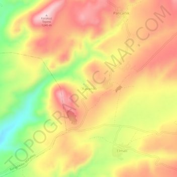
Name: Kavacık topographic map, elevation, terrain.
Location: Kavacık, Çorum, Black Sea Region, Turkey (40.52105 35.01055 40.56105 35.05055)
Average elevation: 1,113 m
Minimum elevation: 917 m
Maximum elevation: 1,253 m
Thank you for supporting this site ❤️
Make a donation
Make a donation
Gear up for your next adventure:
As an Amazon Associate, this site earns from qualifying purchases at no extra cost to you.