Geolocate

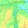
Ridgefield topographic map

Click on the map to display elevation.

About this map

Name: Ridgefield topographic map, elevation, terrain.

Location: Ridgefield, Montgomery, Montgomery County, Alabama, 36106, United States (32.33014 -86.27469 32.37014 -86.23469)

Average elevation: 79 m

Minimum elevation: 59 m

Maximum elevation: 94 m

Other topographic maps

Click on a map to view its topography, its elevation and its terrain.
Gear up for your next adventure:

🦯Trekking Poles - Walking poles for hiking stability
🩹Blister Prevention Tape - Apply to friction points before they become painful sores
🐍Snake Gaiters - Protection against snake bites
🍴Titanium Spork & Cutlery - Indestructible and feather-light eating utensils
🩹First Aid Kits - Emergency kits for hiking

As an Amazon Associate, this site earns from qualifying purchases at no extra cost to you.