
Thank you for supporting this site ❤️
Make a donation
Make a donation
Gear up for your next adventure:
As an Amazon Associate, this site earns from qualifying purchases at no extra cost to you.
Khatgal topographic map
Click on the map to display elevation.
Thank you for supporting this site ❤️
Make a donation
Make a donation
Gear up for your next adventure:
As an Amazon Associate, this site earns from qualifying purchases at no extra cost to you.
About this map
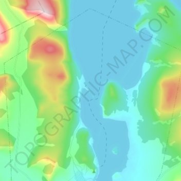
Name: Khatgal topographic map, elevation, terrain.
Location: Khatgal, Alag-Erdene, Hovsgel, Mongolia (50.41350 100.10558 50.53440 100.23838)
Average elevation: 1,766 m
Minimum elevation: 1,640 m
Maximum elevation: 2,151 m
Thank you for supporting this site ❤️
Make a donation
Make a donation
Gear up for your next adventure:
As an Amazon Associate, this site earns from qualifying purchases at no extra cost to you.