
Thank you for supporting this site ❤️
Make a donation
Make a donation
Gear up for your next adventure:
As an Amazon Associate, this site earns from qualifying purchases at no extra cost to you.
Canalda topographic map
Click on the map to display elevation.
Thank you for supporting this site ❤️
Make a donation
Make a donation
Gear up for your next adventure:
As an Amazon Associate, this site earns from qualifying purchases at no extra cost to you.
About this map
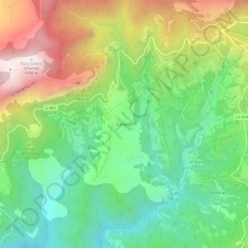
Name: Canalda topographic map, elevation, terrain.
Location: Canalda, Odèn, Solsonès, Catalonia, 25283, Spain (42.10358 1.49790 42.14358 1.53790)
Average elevation: 1,288 m
Minimum elevation: 886 m
Maximum elevation: 1,920 m
Thank you for supporting this site ❤️
Make a donation
Make a donation
Gear up for your next adventure:
As an Amazon Associate, this site earns from qualifying purchases at no extra cost to you.