
Thank you for supporting this site ❤️
Make a donation
Make a donation
Gear up for your next adventure:
As an Amazon Associate, this site earns from qualifying purchases at no extra cost to you.
Reventazón topographic map
Click on the map to display elevation.
Thank you for supporting this site ❤️
Make a donation
Make a donation
Gear up for your next adventure:
As an Amazon Associate, this site earns from qualifying purchases at no extra cost to you.
About this map
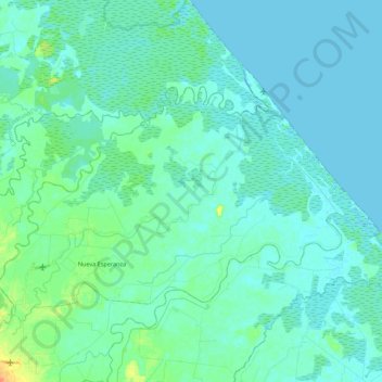
Name: Reventazón topographic map, elevation, terrain.
Location: Reventazón, Siquirres, Limón Province, 70307, Costa Rica (10.17121 -83.49762 10.31694 -83.27736)
Average elevation: 6 m
Minimum elevation: -1 m
Maximum elevation: 37 m
Thank you for supporting this site ❤️
Make a donation
Make a donation
Gear up for your next adventure:
As an Amazon Associate, this site earns from qualifying purchases at no extra cost to you.