
Make a donation
Gear up for your next adventure:
As an Amazon Associate, this site earns from qualifying purchases at no extra cost to you.
Echo Lake topographic map
Click on the map to display elevation.
Make a donation
Gear up for your next adventure:
As an Amazon Associate, this site earns from qualifying purchases at no extra cost to you.
About this map
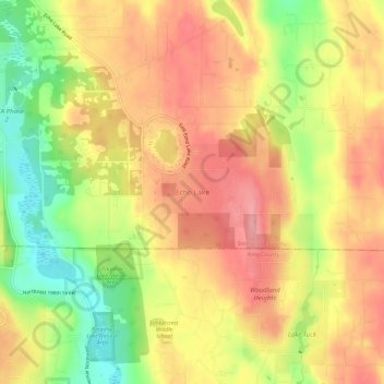
Name: Echo Lake topographic map, elevation, terrain.
Average elevation: 138 m
Minimum elevation: 69 m
Maximum elevation: 187 m
Make a donation
Gear up for your next adventure:
As an Amazon Associate, this site earns from qualifying purchases at no extra cost to you.
Other topographic maps
Click on a map to view its topography, its elevation and its terrain.
Arlington
United States > Washington > Snohomish County
The city lies on a glacial terrace formed during the Pleistocene epoch by the recession of the Cordilleran Ice Sheet. Arlington covers a series of hills that sit at an elevation of 100 to 200 feet (30 to 61 m) above sea level. Downtown Arlington is situated on a bluff above the confluence of the Stillaguamish…
Average elevation: 60 m
Monroe
United States > Washington > Snohomish County
The city lies at the eastern end of the Snohomish River floodplain, with elevations that range from 40 to 210 feet (12 to 64 m). The south and east edges of the city along the Skykomish River are within a 100-year flood hazard zone and also include habitats for migratory birds and game animals. The residential…
Average elevation: 49 m
Make a donation
Gear up for your next adventure:
As an Amazon Associate, this site earns from qualifying purchases at no extra cost to you.
Make a donation
Gear up for your next adventure:
As an Amazon Associate, this site earns from qualifying purchases at no extra cost to you.