
Thank you for supporting this site ❤️
Make a donation
Make a donation
Gear up for your next adventure:
As an Amazon Associate, this site earns from qualifying purchases at no extra cost to you.
Wainwright topographic map
Click on the map to display elevation.
Thank you for supporting this site ❤️
Make a donation
Make a donation
Gear up for your next adventure:
As an Amazon Associate, this site earns from qualifying purchases at no extra cost to you.
About this map
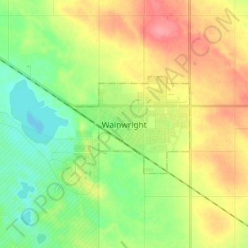
Name: Wainwright topographic map, elevation, terrain.
Location: Wainwright, Town of Wainwright, Alberta, T9W 1C5, Canada (52.79743 -110.90121 52.87743 -110.82121)
Average elevation: 685 m
Minimum elevation: 651 m
Maximum elevation: 731 m
Thank you for supporting this site ❤️
Make a donation
Make a donation
Gear up for your next adventure:
As an Amazon Associate, this site earns from qualifying purchases at no extra cost to you.