Geolocate

Folkestone topographic map

Click on the map to display elevation.

About this map

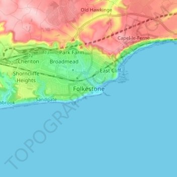
Name: Folkestone topographic map, elevation, terrain.

Location: Folkestone, Kent, South East, England, CT20 1RZ, United Kingdom (51.03913 1.13941 51.11913 1.21941)

Average elevation: 46 m

Minimum elevation: 0 m

Maximum elevation: 189 m

Gear up for your next adventure:

🧭Global Orienteering Compass - High-precision liquid-filled compasses for accurate map reading and navigation
🧼Biodegradable Soap - Eco-friendly outdoor soap
👕UPF 50+ Sun Shirts - Essential protection against the harsh Australian sun during field work
📣High-Decibel Survival Whistles - Signaling tool for rescue that carries much further than a human voice
🔋Rechargeable Batteries - Eco-friendly power for high-drain GPS units and flashlights

As an Amazon Associate, this site earns from qualifying purchases at no extra cost to you.