
Edgerton topographic map
Interactive map
Click on the map to display elevation.
About this map
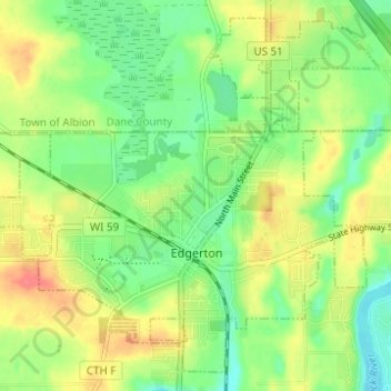
Name: Edgerton topographic map, elevation, terrain.
Location: Edgerton, Rock County, Wisconsin, 53534, United States (42.81960 -89.10217 42.86066 -89.04048)
Average elevation: 261 m
Minimum elevation: 236 m
Maximum elevation: 292 m
Other topographic maps
Click on a map to view its topography, its elevation and its terrain.
Rock County
United States > Wisconsin > Rock County
Rock County, Wisconsin, United States
Average elevation: 266 m