Geolocate

Neckargemünd topographic map

Click on the map to display elevation.

About this map
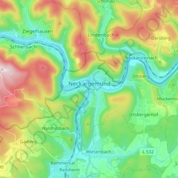
Name: Neckargemünd topographic map, elevation, terrain.

Location: Neckargemünd, GVV Neckargemünd, Rhein-Neckar-Kreis, Baden-Württemberg, 69151, Germany (49.36873 8.75472 49.41624 8.89119)

Average elevation: 247 m

Minimum elevation: 106 m

Maximum elevation: 481 m

Other topographic maps

Click on a map to view its topography, its elevation and its terrain.
Gear up for your next adventure:

☕Outdoor Coffee Makers - Enjoy quality coffee at the summit of your favorite peak
📡Portable Emergency Radios - Stay informed about weather warnings and bushfire alerts
🛠️Outdoor Repair Kits - Gear repair kits
📻Handheld UHF Radios - Critical communication for groups in the Australian outback
🧯Animal Deterrent Spray - Safety spray for wildlife

As an Amazon Associate, this site earns from qualifying purchases at no extra cost to you.