
Guaviare topographic map
Interactive map
Click on the map to display elevation.
About this map
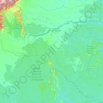
Name: Guaviare topographic map, elevation, terrain.
Location: Guaviare, Kolumbien (0.65427 -73.66122 2.92484 -69.99451)
Average elevation: 275 m
Minimum elevation: 115 m
Maximum elevation: 3,690 m
Other topographic maps
Click on a map to view its topography, its elevation and its terrain.