Geolocate

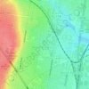
Barwon Heads topographic map

Click on the map to display elevation.

About this map

Name: Barwon Heads topographic map, elevation, terrain.

Location: Barwon Heads, Geelong, Victoria, Australia (-38.29079 144.46900 -38.25677 144.50825)

Average elevation: 4 m

Minimum elevation: -1 m

Maximum elevation: 29 m

Victoria trails, hiking, mountain biking, running and outdoor activities

Other topographic maps

Click on a map to view its topography, its elevation and its terrain.
Armstrong Creek

Australia > Victoria > Geelong

Average elevation: 47 m

Buckley Falls Park

Australia > Victoria > Geelong

Average elevation: 43 m

Hume Reserve

Australia > Victoria > Geelong

Average elevation: 32 m

Mount Duneed

Australia > Victoria > Geelong

Average elevation: 56 m

Wombat Hill

Australia > Victoria > Geelong

Average elevation: 40 m

Vincent Park

Australia > Victoria > Geelong

Average elevation: 10 m

Lincoln Reserve

Australia > Victoria > Geelong

Average elevation: 19 m

Gear up for your next adventure:

📚Map Reading & Navigation Guides - Master the art of interpreting topographic contours and symbols
🥶Thermal Beanies - Warm hats for cold hikes
📱Shockproof Phone Cases - Extra protection for your smartphone against drops on rocky terrain
🎧Bluetooth Outdoor Earbuds - Listen to navigation cues or podcasts during long solo treks
🌿Flora and Fauna Field Guides - Identify the plants and animals you encounter on your route

As an Amazon Associate, this site earns from qualifying purchases at no extra cost to you.