
West Amesbury topographic map
Interactive map
Click on the map to display elevation.
About this map
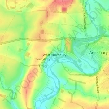
Name: West Amesbury topographic map, elevation, terrain.
Location: West Amesbury, Wiltshire, England, SP4 7BH, United Kingdom (51.15185 -1.82087 51.19185 -1.78087)
Average elevation: 90 m
Minimum elevation: 59 m
Maximum elevation: 129 m
Other topographic maps
Click on a map to view its topography, its elevation and its terrain.