
Ferro topographic map
Interactive map
Click on the map to display elevation.
About this map
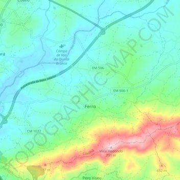
Name: Ferro topographic map, elevation, terrain.
Location: Ferro, Covilhã, Castelo Branco, 6200-571, Portugal (40.21061 -7.49704 40.27021 -7.40782)
Average elevation: 497 m
Minimum elevation: 404 m
Maximum elevation: 778 m
Other topographic maps
Click on a map to view its topography, its elevation and its terrain.
Covilhã
Portugal > Castelo Branco > Covilhã
Covilhã, Castelo Branco, 6200-065, Portugal
Average elevation: 738 m