
Thank you for supporting this site ❤️
Make a donation
Make a donation
Gear up for your next adventure:
As an Amazon Associate, this site earns from qualifying purchases at no extra cost to you.
Calvitero topographic map
Click on the map to display elevation.
Thank you for supporting this site ❤️
Make a donation
Make a donation
Gear up for your next adventure:
As an Amazon Associate, this site earns from qualifying purchases at no extra cost to you.
About this map
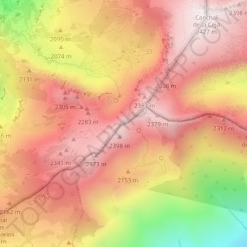
Name: Calvitero topographic map, elevation, terrain.
Location: Calvitero, Candelario, Salamanca, Castilla y León, España (40.29213 -5.74088 40.29223 -5.74078)
Average elevation: 2,145 m
Minimum elevation: 1,621 m
Maximum elevation: 2,427 m
Thank you for supporting this site ❤️
Make a donation
Make a donation
Gear up for your next adventure:
As an Amazon Associate, this site earns from qualifying purchases at no extra cost to you.