
Thank you for supporting this site ❤️
Make a donation
Make a donation
Gear up for your next adventure:
As an Amazon Associate, this site earns from qualifying purchases at no extra cost to you.
Arevabuyr topographic map
Click on the map to display elevation.
Thank you for supporting this site ❤️
Make a donation
Make a donation
Gear up for your next adventure:
As an Amazon Associate, this site earns from qualifying purchases at no extra cost to you.
About this map
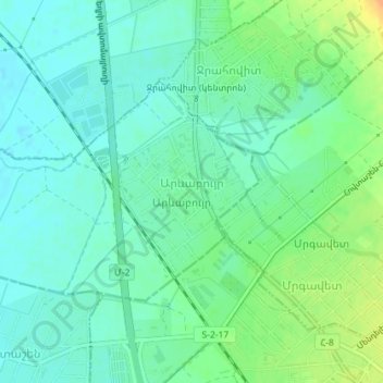
Name: Arevabuyr topographic map, elevation, terrain.
Location: Arevabuyr, Masis municipality, Ararat Province, 0820, Armenia (40.02773 44.44053 40.04343 44.47635)
Average elevation: 834 m
Minimum elevation: 823 m
Maximum elevation: 857 m
Thank you for supporting this site ❤️
Make a donation
Make a donation
Gear up for your next adventure:
As an Amazon Associate, this site earns from qualifying purchases at no extra cost to you.