
Colldelrat topographic map
Interactive map
Click on the map to display elevation.
About this map
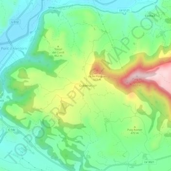
Name: Colldelrat topographic map, elevation, terrain.
Location: Colldelrat, Artesa de Segre, Noguera, Cataluña, 25739, España (41.87950 1.07256 41.91950 1.11256)
Average elevation: 425 m
Minimum elevation: 307 m
Maximum elevation: 661 m
Other topographic maps
Click on a map to view its topography, its elevation and its terrain.
Coll de Comiols
España > Cataluña > Noguera > Artesa de Segre
Coll de Comiols, Artesa de Segre, Noguera, Lérida, Cataluña, 25730, España
Average elevation: 1,029 m