
Moignelée topographic map
Interactive map
Click on the map to display elevation.
About this map
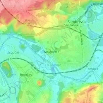
Name: Moignelée topographic map, elevation, terrain.
Location: Moignelée, Namur, Wallonie, 5060, Belgique (50.41784 4.56856 50.45784 4.60856)
Average elevation: 118 m
Minimum elevation: 85 m
Maximum elevation: 183 m