Geolocate

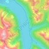
Custer Ridge topographic map

Click on the map to display elevation.

About this map

Name: Custer Ridge topographic map, elevation, terrain.

Location: Custer Ridge, Area E (Chilliwack River Valley), Fraser Valley Regional District, British Columbia, Canada (49.07918 -121.34261 49.09918 -121.32261)

Average elevation: 1,629 m

Minimum elevation: 1,184 m

Maximum elevation: 2,055 m

Other topographic maps

Click on a map to view its topography, its elevation and its terrain.
Gear up for your next adventure:

🐍Australian Snake Bite Kits - Specific pressure immobilization bandages for Australian venomous snakes
🚁Camera Drones with GPS - Capture aerial views of the landscape to compare with topo maps
🛠️Outdoor Repair Kits - Gear repair kits
🧴SPF 50+ Bulk Sunscreen - Maximum protection for long-term outdoor exposure
🥾Hiking Boots - Durable hiking boots for trails and rough terrain

As an Amazon Associate, this site earns from qualifying purchases at no extra cost to you.