Geolocate

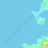
Balanacan topographic map

Click on the map to display elevation.

About this map

Name: Balanacan topographic map, elevation, terrain.

Location: Balanacan, Mogpog, 1st District, Marinduque, Mimaropa, 4901, Philippines (13.50839 121.84810 13.54839 121.88810)

Average elevation: 74 m

Minimum elevation: -2 m

Maximum elevation: 380 m

Other topographic maps

Click on a map to view its topography, its elevation and its terrain.
Agpisan Island

Philippines > Marinduque > Mogpog

Average elevation: 4 m

Atta Island

Philippines > Marinduque > Mogpog

Average elevation: 6 m

Gear up for your next adventure:

🔋Rechargeable Batteries - Eco-friendly power for high-drain GPS units and flashlights
🕶️Polarized Sunglasses - UV protection sunglasses for outdoors
🧼Biodegradable Soap - Eco-friendly outdoor soap
🧼Clip-on Hand Sanitizer - Maintain hygiene when water for washing is scarce
🔥Ferrocerium Rod Fire Starters - Reliable fire lighting in wet or windy conditions without matches

As an Amazon Associate, this site earns from qualifying purchases at no extra cost to you.