
Thank you for supporting this site ❤️
Make a donation
Make a donation
Gear up for your next adventure:
As an Amazon Associate, this site earns from qualifying purchases at no extra cost to you.
Millu topographic map
Click on the map to display elevation.
Thank you for supporting this site ❤️
Make a donation
Make a donation
Gear up for your next adventure:
As an Amazon Associate, this site earns from qualifying purchases at no extra cost to you.
About this map
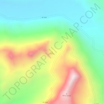
Name: Millu topographic map, elevation, terrain.
Location: Millu, Oropesa, Province of Antabamba, Apurímac, Peru (-14.58288 -72.52005 -14.58278 -72.51995)
Average elevation: 4,853 m
Minimum elevation: 4,624 m
Maximum elevation: 5,191 m
Thank you for supporting this site ❤️
Make a donation
Make a donation
Gear up for your next adventure:
As an Amazon Associate, this site earns from qualifying purchases at no extra cost to you.