
Isle of Purbeck topographic map
Interactive map
Click on the map to display elevation.
About this map
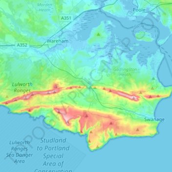
Name: Isle of Purbeck topographic map, elevation, terrain.
Location: Isle of Purbeck, Corfe Castle, Dorset, England, United Kingdom (50.57567 -2.19327 50.70799 -1.92229)
Average elevation: 27 m
Minimum elevation: -7 m
Maximum elevation: 201 m