Geolocate

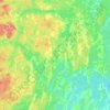
Tatlock topographic map

Click on the map to display elevation.

About this map

Name: Tatlock topographic map, elevation, terrain.

Location: Tatlock, Lanark Highlands, Lanark County, Eastern Ontario, Ontario, Canada (45.15661 -76.49205 45.17661 -76.47205)

Average elevation: 198 m

Minimum elevation: 168 m

Maximum elevation: 262 m

Other topographic maps

Click on a map to view its topography, its elevation and its terrain.

Barbers Lake

Canada > Ontario > Lanark County > Lanark Highlands

Average elevation: 194 m

Darling

Canada > Ontario > Lanark County > Lanark Highlands

Average elevation: 203 m

Gear up for your next adventure:

🧤Thermal Hiking Gloves - Keep your hands warm and functional during high-altitude winter treks
🧦Hiking Socks - Comfortable socks for long hikes
🍳Camping Cookware - Cookware sets for outdoor meals
🔋Rechargeable Batteries - Eco-friendly power for high-drain GPS units and flashlights
🚴Bike GPS - GPS devices for cycling

As an Amazon Associate, this site earns from qualifying purchases at no extra cost to you.