Geolocate

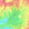
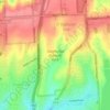
Firle topographic map

Click on the map to display elevation.

About this map

Other topographic maps

Click on a map to view its topography, its elevation and its terrain.
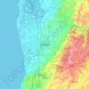
Adelaide

Australia > South Australia > Adelaide

Adelaide is north of the Fleurieu Peninsula, on the Adelaide Plains between the Gulf St Vincent and the low-lying Mount Lofty Ranges. The city stretches 20 km (12 mi) from the coast to the foothills, and 90 km (56 mi) from Gawler at its northern extent to Sellicks Beach in the south. According to the Regional…

Average elevation: 148 m
Anstey Hill

Australia > South Australia > Adelaide

Average elevation: 292 m

CC Hood Reserve

Australia > South Australia > Adelaide

Average elevation: 117 m

Tennyson

Australia > South Australia > Adelaide

Average elevation: 4 m

Lockleys Oval

Australia > South Australia > Adelaide

Average elevation: 10 m

O'Halloran Hill

Australia > South Australia > Adelaide

Average elevation: 158 m

Seaforth Park

Australia > South Australia > Adelaide

Average elevation: 7 m

Tennyson Beach

Australia > South Australia > Adelaide

Average elevation: 3 m

Tusmore Park

Australia > South Australia > Adelaide

Average elevation: 99 m

Rundle Park

Australia > South Australia > Adelaide

Average elevation: 49 m

Denton Reserve

Australia > South Australia > Adelaide

Average elevation: 169 m

Gear up for your next adventure:

🧼Biodegradable Soap - Eco-friendly outdoor soap
🎨Portable Watercolor Kits - Paint the landscapes and topographic views you discover
🪫Rechargeable Headlamps - USB rechargeable headlamps
🥾Heavy Duty Hiking Boots - Ankle-supporting boots for carrying heavy packs on steep contours
🎒Hiking Backpacks - Backpacks designed for hiking and trekking

As an Amazon Associate, this site earns from qualifying purchases at no extra cost to you.