
Thank you for supporting this site ❤️
Make a donation
Make a donation
Gear up for your next adventure:
As an Amazon Associate, this site earns from qualifying purchases at no extra cost to you.
Łeba topographic map
Click on the map to display elevation.
Thank you for supporting this site ❤️
Make a donation
Make a donation
Gear up for your next adventure:
As an Amazon Associate, this site earns from qualifying purchases at no extra cost to you.
About this map
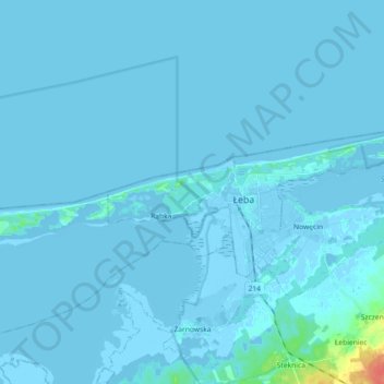
Name: Łeba topographic map, elevation, terrain.
Location: Łeba, Lębork County, Pomeranian Voivodeship, Poland (54.73734 17.49125 54.78334 17.67246)
Average elevation: 1 m
Minimum elevation: -5 m
Maximum elevation: 41 m
Thank you for supporting this site ❤️
Make a donation
Make a donation
Gear up for your next adventure:
As an Amazon Associate, this site earns from qualifying purchases at no extra cost to you.