Geolocate

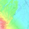
Nillow topographic map

Click on the map to display elevation.

About this map

Name: Nillow topographic map, elevation, terrain.

Location: Nillow, Kulgam, Kulgam District, Jammu and Kashmir, India (33.66047 74.94748 33.66753 74.95512)

Average elevation: 1,824 m

Minimum elevation: 1,781 m

Maximum elevation: 1,868 m

Other topographic maps

Click on a map to view its topography, its elevation and its terrain.

Pambai

India > Jammu and Kashmir > Kulgam

Average elevation: 1,856 m

Pariwan

India > Jammu and Kashmir > Kulgam

Average elevation: 1,885 m

Madargom

India > Jammu and Kashmir > Kulgam

Average elevation: 1,824 m

Khanabal

India > Jammu and Kashmir > Kulgam

Average elevation: 1,597 m

Yaripora

India > Jammu and Kashmir > Kulgam

Average elevation: 1,672 m

Tirigom

India > Jammu and Kashmir > Kulgam

Average elevation: 1,716 m

Yaripora

India > Jammu and Kashmir > Kulgam

Average elevation: 1,672 m

Frisal

India > Jammu and Kashmir > Kulgam

Average elevation: 1,624 m

Tirigom

India > Jammu and Kashmir > Kulgam

Average elevation: 1,716 m

Gear up for your next adventure:

🦟Heavy Duty Insect Repellent - Essential protection against flies, mozzies, and march flies
🧭Compass - Navigation compasses for outdoor exploration
📻Handheld UHF Radios - Critical communication for groups in the Australian outback
🧢Wide Brim Sun Hats - Maximum coverage for the face and neck while out in the open
🧥Down Jackets - Insulated jackets for cold weather

As an Amazon Associate, this site earns from qualifying purchases at no extra cost to you.