
La Seguinerie topographic map
Interactive map
Click on the map to display elevation.
About this map
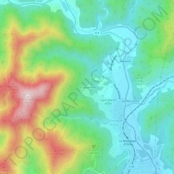
Name: La Seguinerie topographic map, elevation, terrain.
Average elevation: 404 m
Minimum elevation: 239 m
Maximum elevation: 768 m
Other topographic maps
Click on a map to view its topography, its elevation and its terrain.
Saint-Martin d'Orb
France > Occitanie > Hérault > Le Bousquet-d'Orb
Saint-Martin d'Orb, Le Bousquet-d'Orb, Béziers, Hérault, Occitanie, France métropolitaine, 34260, France
Average elevation: 382 m
Fontenilles
France > Occitanie > Hérault > Le Bousquet-d'Orb
Fontenilles, Le Bousquet-d'Orb, Béziers, Hérault, Occitanie, France métropolitaine, 34260, France
Average elevation: 377 m