
Town of Trochu topographic map
Interactive map
Click on the map to display elevation.
About this map
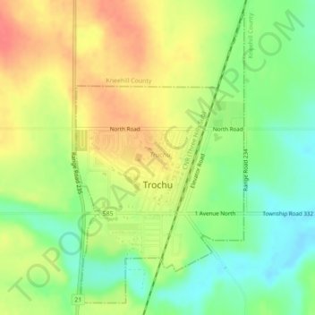
Name: Town of Trochu topographic map, elevation, terrain.
Location: Town of Trochu, Truchu, Alberta, T0M 2C0, Canada (51.81602 -113.24100 51.84095 -113.21769)
Average elevation: 870 m
Minimum elevation: 841 m
Maximum elevation: 898 m