
Oerbke topographic map
Interactive map
Click on the map to display elevation.
About this map
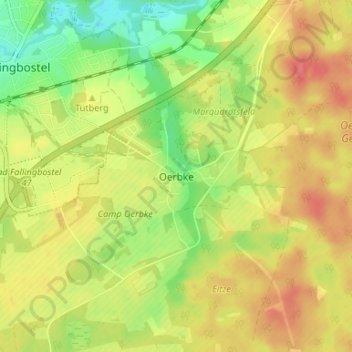
Name: Oerbke topographic map, elevation, terrain.
Average elevation: 69 m
Minimum elevation: 35 m
Maximum elevation: 98 m
Other topographic maps
Click on a map to view its topography, its elevation and its terrain.
Im Katzhagen
Deutschland > Niedersachsen > Heidekreis > Osterheide > Ostenholz > Im Katzhagen
Im Katzhagen, Ostenholz, Osterheide, Heidekreis, Niedersachsen, Deutschland
Average elevation: 50 m