
Iqaluit ᐃᖃᓗᐃᑦ topographic map
Interactive map
Click on the map to display elevation.
About this map
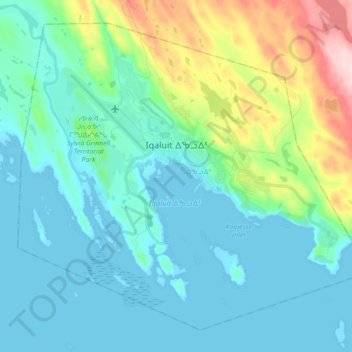
Name: Iqaluit ᐃᖃᓗᐃᑦ topographic map, elevation, terrain.
Location: Iqaluit ᐃᖃᓗᐃᑦ, ᐃᖃᓗᐃᑦ, Region Qikiqtaaluk, Nunavut, Kanada (63.70852 -68.60121 63.77634 -68.42543)
Average elevation: 50 m
Minimum elevation: 0 m
Maximum elevation: 250 m
Other topographic maps
Click on a map to view its topography, its elevation and its terrain.