
Ștefăneștii de Jos topographic map
Interactive map
Click on the map to display elevation.
About this map
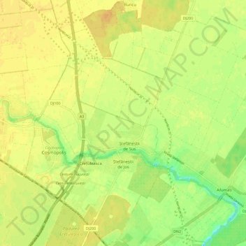
Name: Ștefăneștii de Jos topographic map, elevation, terrain.
Location: Ștefăneștii de Jos, Ilfov, 077175, Romania (44.50617 26.15791 44.58658 26.22988)
Average elevation: 86 m
Minimum elevation: 68 m
Maximum elevation: 95 m
Other topographic maps
Click on a map to view its topography, its elevation and its terrain.