
Boekt topographic map
Interactive map
Click on the map to display elevation.
About this map
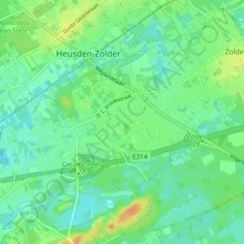
Name: Boekt topographic map, elevation, terrain.
Location: Boekt, Zolder, Heusden-Zolder, Hasselt, Limburg, 3550, België (50.99211 5.26383 51.03211 5.30383)
Average elevation: 35 m
Minimum elevation: 23 m
Maximum elevation: 59 m
Other topographic maps
Click on a map to view its topography, its elevation and its terrain.
Bolderberg
België > Limburg > Hasselt > Heusden-Zolder > Zolder
Bolderberg, Zolder, Heusden-Zolder, Hasselt, Limburg, 3550, België
Average elevation: 32 m