Geolocate

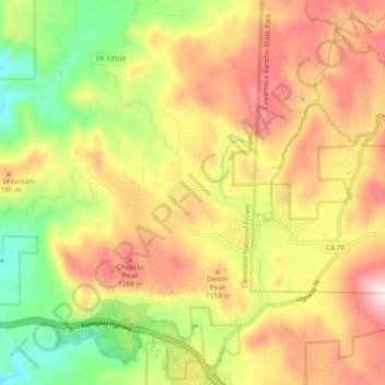
Descanso topographic map

Click on the map to display elevation.

Descanso

Descanso is located east of Alpine and west of Pine Valley. At a 3,450 feet (1,050 m) elevation, it is located at the south entrance to Cuyamaca Rancho State Park and also borders Cleveland National Forest to the west and east.

Wikipedia (CC-BY-SA 3.0)

About this map

Name: Descanso topographic map, elevation, terrain.

Location: Descanso, San Diego County, California, 91916, United States (32.82729 -116.66862 32.90230 -116.57480)

Average elevation: 1,067 m

Minimum elevation: 692 m

Maximum elevation: 1,440 m

Gear up for your next adventure:

🔌Fast Charging Adapters - Quickly top up all your gear before heading back into the field
🪢550 Survival Paracord - Versatile cordage for gear repair and emergency lashing
🧣Merino Neck Gaiters - Versatile headwear for warmth, sun protection, or dust filtering
🪢Paracord - Multi-purpose survival cord
🔪Multitools - Compact tools for outdoor use

As an Amazon Associate, this site earns from qualifying purchases at no extra cost to you.