
Shangombo topographic map
Interactive map
Click on the map to display elevation.
About this map
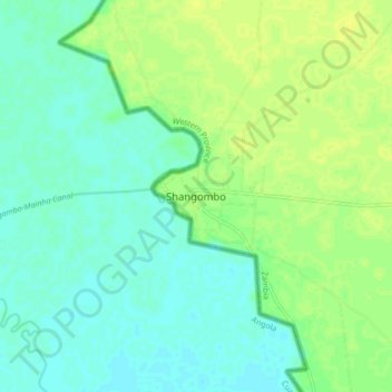
Name: Shangombo topographic map, elevation, terrain.
Location: Shangombo, Shang'ombo District, Western Province, Zambia (-16.36167 22.05983 -16.28167 22.13983)
Average elevation: 1,027 m
Minimum elevation: 1,019 m
Maximum elevation: 1,037 m