Geolocate

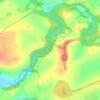
Knockentiber topographic map

Click on the map to display elevation.

About this map

Name: Knockentiber topographic map, elevation, terrain.

Location: Knockentiber, East Ayrshire, Scotland, KA2 0DY, United Kingdom (55.60111 -4.56500 55.64111 -4.52500)

Average elevation: 44 m

Minimum elevation: 11 m

Maximum elevation: 84 m

Other topographic maps

Click on a map to view its topography, its elevation and its terrain.

Braid Wood

United Kingdom > Scotland > East Ayrshire

Average elevation: 114 m

Glenbuck Loch

United Kingdom > Scotland > East Ayrshire

Average elevation: 327 m

Loch Doon

United Kingdom > Scotland > East Ayrshire

Average elevation: 291 m

River Doon

United Kingdom > Scotland > East Ayrshire > Dalrymple

Average elevation: 168 m

River Ayr

United Kingdom > Scotland > East Ayrshire

Average elevation: 210 m

Gear up for your next adventure:

🧼Biodegradable Outdoor Soap - Clean gear and yourself without harming the local ecosystem
🥤Outdoor Water Bottles - Reusable bottles for outdoor activities
🧴SPF 50+ Bulk Sunscreen - Maximum protection for long-term outdoor exposure
🧦Hiking Socks - Comfortable socks for long hikes
🧥Insulated Down Jackets - High warmth-to-weight ratio for cold nights in the high country

As an Amazon Associate, this site earns from qualifying purchases at no extra cost to you.