
Palm River topographic map
Interactive map
Click on the map to display elevation.
About this map
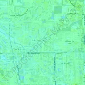
Name: Palm River topographic map, elevation, terrain.
Average elevation: 6 m
Minimum elevation: 1 m
Maximum elevation: 9 m
Other topographic maps
Click on a map to view its topography, its elevation and its terrain.
Palm River
États-Unis d'Amérique > Floride > Collier County > Pelican Marsh > Palm River
Palm River, Pelican Marsh, Collier County, Floride, 34110, États-Unis d'Amérique
Average elevation: 6 m
Naples
États-Unis d'Amérique > Floride > Collier County
Naples, Collier County, Floride, États-Unis d'Amérique
Average elevation: 3 m
Collier County
États-Unis d'Amérique > Floride > Collier County
Collier County, Floride, États-Unis d'Amérique
Average elevation: 5 m