Geolocate

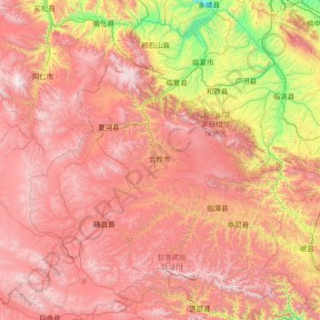
Gannan topographic map

Click on the map to display elevation.

Gannan

Gannan, as illustrated by this chart for Xiahe, has an alpine subarctic climate (Köppen Dwc) that grades into an alpine climate (ETH) at the highest elevations. The climate is characterised by mild, rainy summers and frigid, but dry and sunny, winters.

Wikipedia (CC-BY-SA 3.0)

About this map

Name: Gannan topographic map, elevation, terrain.

Location: Gannan, Tongqin, Hezuo City, Gannan Tibetan Autonomous Prefecture, Gansu, 747000, China (33.98453 101.91059 35.98453 103.91059)

Average elevation: 3,075 m

Minimum elevation: 1,621 m

Maximum elevation: 4,740 m

Gear up for your next adventure:

🥾Trail Running Shoes - Shoes for trail running
🔋Solar Power Banks - Solar chargers for outdoors
🚁Camera Drones with GPS - Capture aerial views of the landscape to compare with topo maps
🧺Waterproof Dry Sacks - Organize your pack and keep electronics safe from rain and river crossings
👖Convertible Hiking Trousers - Zip-off legs to adapt to changing temperatures throughout the day

As an Amazon Associate, this site earns from qualifying purchases at no extra cost to you.