Geolocate

Barking topographic map

Click on the map to display elevation.

About this map

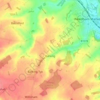
Name: Barking topographic map, elevation, terrain.

Location: Barking, Mid Suffolk, Suffolk, England, United Kingdom (52.11853 1.00127 52.16083 1.05796)

Average elevation: 55 m

Minimum elevation: 16 m

Maximum elevation: 81 m

Other topographic maps

Click on a map to view its topography, its elevation and its terrain.

Forward Green

United Kingdom > England > Suffolk > Mid Suffolk

Average elevation: 55 m

Eye Castle

United Kingdom > England > Suffolk > Mid Suffolk > Eye

Average elevation: 39 m

Haughley Green

United Kingdom > England > Suffolk > Mid Suffolk

Average elevation: 61 m

Brome

United Kingdom > England > Suffolk > Mid Suffolk

Average elevation: 40 m

Earl Stonham

United Kingdom > England > Suffolk > Mid Suffolk

Average elevation: 55 m

Rickinghall

United Kingdom > England > Suffolk > Mid Suffolk

Average elevation: 46 m

Needham Lake

United Kingdom > England > Suffolk > Mid Suffolk

Average elevation: 33 m

Mill Green

United Kingdom > England > Suffolk > Mid Suffolk

Average elevation: 60 m

Old Newton

United Kingdom > England > Suffolk > Mid Suffolk

Average elevation: 56 m

Borley Green

United Kingdom > England > Suffolk > Mid Suffolk > Woolpit

Average elevation: 62 m

Woolpit Green

United Kingdom > England > Suffolk > Mid Suffolk > Woolpit

Average elevation: 64 m

Winston Green

United Kingdom > England > Suffolk > Mid Suffolk

Average elevation: 53 m

Pixey Green

United Kingdom > England > Suffolk > Mid Suffolk

Average elevation: 50 m

Gear up for your next adventure:

🚗Car Camping Gear - Equipment for vehicle camping
🔑Heavy Duty Carabiners - Secure gear to the outside of your pack for easy access
🛌Sleeping Mats - Insulated mats for camping comfort
📡Weather Radios - Emergency weather radios
📻Handheld UHF Radios - Critical communication for groups in the Australian outback

As an Amazon Associate, this site earns from qualifying purchases at no extra cost to you.