
Herbern topographic map
Interactive map
Click on the map to display elevation.
About this map
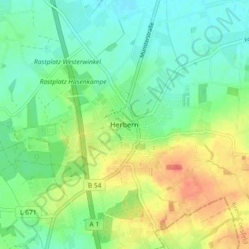
Name: Herbern topographic map, elevation, terrain.
Average elevation: 86 m
Minimum elevation: 69 m
Maximum elevation: 114 m
Other topographic maps
Click on a map to view its topography, its elevation and its terrain.
Davensberg
Deutschland > Nordrhein-Westfalen > Kreis Coesfeld > Ascheberg > Davensberg
Davensberg, Ascheberg, Kreis Coesfeld, Nordrhein-Westfalen, Deutschland
Average elevation: 63 m