
Make a donation
Gear up for your next adventure:
As an Amazon Associate, this site earns from qualifying purchases at no extra cost to you.
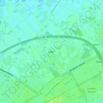
Laar topographic map
Click on the map to display elevation.
Make a donation
Gear up for your next adventure:
As an Amazon Associate, this site earns from qualifying purchases at no extra cost to you.
Laar
Laar is gelegen in het landelijk gebied ten noordwesten van Weert op een hoogte van ongeveer 32 meter. Door de aanleg van autowegen, bedrijventerreinen en -in het eerste kwart van de 21e eeuw- ook woonwijken komt de stad steeds dichterbij. Ten zuiden van Laar wordt de nieuwe woonwijk Laarveld gerealiseerd. Het dorp is hierdoor feitelijk vastgegroeid aan de stad Weert. Op initiatief van de dorpsraad en de gemeenteraad wordt er een groene buffer gerealiseerd tussen de nieuwe wijk en Laar waardoor het dorpse karakter behouden blijft. Ten zuidoosten van Laar ligt bedrijventerrein Kampershoek, vroeger een buurtschap.
Make a donation
Gear up for your next adventure:
As an Amazon Associate, this site earns from qualifying purchases at no extra cost to you.
About this map
Name: Laar topographic map, elevation, terrain.
Location: Laar, Weert, Limburg, Nederland, 6003 PC, Nederland (51.25737 5.68662 51.29737 5.72662)
Average elevation: 33 m
Minimum elevation: 29 m
Maximum elevation: 39 m
Make a donation
Gear up for your next adventure:
As an Amazon Associate, this site earns from qualifying purchases at no extra cost to you.
Other topographic maps
Click on a map to view its topography, its elevation and its terrain.