
Thank you for supporting this site ❤️
Make a donation
Make a donation
Gear up for your next adventure:
As an Amazon Associate, this site earns from qualifying purchases at no extra cost to you.
Hobhouse topographic map
Click on the map to display elevation.
Thank you for supporting this site ❤️
Make a donation
Make a donation
Gear up for your next adventure:
🧦Merino Wool Hiking Socks - Moisture-wicking socks to prevent blisters during long topographic surveys
As an Amazon Associate, this site earns from qualifying purchases at no extra cost to you.
About this map
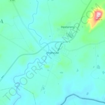
Name: Hobhouse topographic map, elevation, terrain.
Average elevation: 1,494 m
Minimum elevation: 1,436 m
Maximum elevation: 1,881 m
Thank you for supporting this site ❤️
Make a donation
Make a donation
Gear up for your next adventure:
As an Amazon Associate, this site earns from qualifying purchases at no extra cost to you.
Other topographic maps
Click on a map to view its topography, its elevation and its terrain.
Mantsopa Ward 8
South Africa > Free State > Thabo Mofutsanyana District Municipality > Mantsopa Local Municipality
Average elevation: 1,588 m