Geolocate

Lika topographic map

Click on the map to display elevation.

About this map

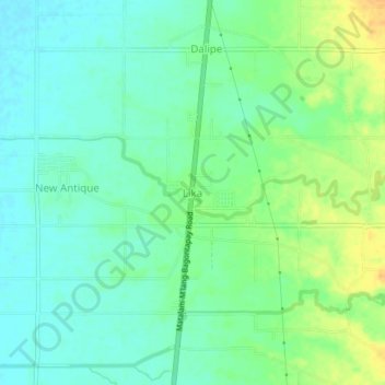
Name: Lika topographic map, elevation, terrain.

Location: Lika, M'lang, North Cotabato, Soccsksargen, 9402, Philippines (6.97035 124.87171 7.01035 124.91171)

Average elevation: 24 m

Minimum elevation: 12 m

Maximum elevation: 44 m

Gear up for your next adventure:

🎧Bluetooth Outdoor Earbuds - Listen to navigation cues or podcasts during long solo treks
Survival Blankets - Emergency thermal blankets
🛌Sleeping Bags - Sleeping bags for outdoor camping
🧊Insulated Cooler Bags - Keep food fresh for day trips to remote geographic sites
📕Hiking Guide Books - Guides for hiking trails

As an Amazon Associate, this site earns from qualifying purchases at no extra cost to you.