
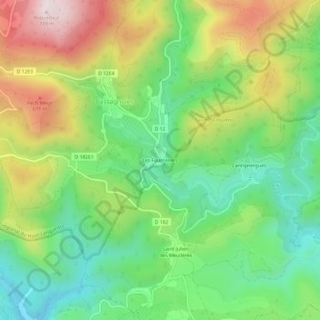
Les Fourneliers topographic map
Interactive map
Click on the map to display elevation.
About this map
Name: Les Fourneliers topographic map, elevation, terrain.
Average elevation: 455 m
Minimum elevation: 236 m
Maximum elevation: 793 m
Other topographic maps
Click on a map to view its topography, its elevation and its terrain.
Mancès
France > Occitanie > Hérault > Cassagnoles
Mancès, Cassagnoles, Béziers, Hérault, Occitanie, France métropolitaine, 34210, France
Average elevation: 708 m